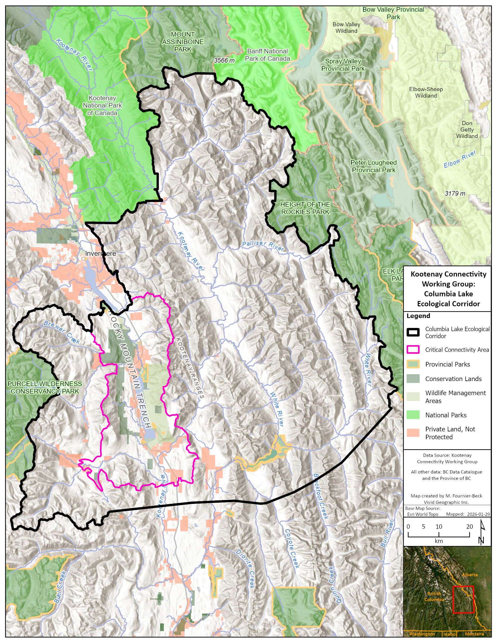
We envision establishing a multi-jurisdictional Ecological Corridor centered on Columbia Lake in the East Kootenays at the headwaters of the Columbia River.
Columbia Lake Ecological Corridor is part of a large landscape where the Ktunaxa people have longstanding cultural, spiritual and historical connections and lies at the heart of their traditional territory, known as ʔamakʔis Ktunaxa. This landscape has sustained people, wildlife, and ecological connections since time immemorial. The area has been a physical and spiritual gathering place that whispers an ancient and perpetual connection to ancestral land. We respectfully acknowledge the enduring stewardship, knowledge, and relationships that continue to guide the care of this place.
A meeting place where nature and people are deeply connected.
The 4,434 km2 Ecological Corridor is anchored in the east by three protected areas: Kootenay National Park, Height of the Rockies and Elk Lakes Provincial Parks; and extends west to the Purcell Wilderness Conservancy. It includes a mosaic of provincial, ʔakisq̓nuk First Nation Reserve, land trust, and private lands, and encompasses the Village of Canal Flats and community of Fairmont Hot Springs.


yaqaⱡ hankatiⱡiⱡki na ʔamak
Our approach incorporates the ecological corridor principles of the International Union for the Conservation of Nature (IUCN) and Environment and Climate Change Canada (ECCC) and adheres to Ktunaxa law and the stewardship principle of yaqaⱡ hankatiⱡiⱡki na ʔamak, which translates approximately to “our people care for the land, the land cares for our people.”
The Columbia Lake Ecological Corridor presents a strong opportunity to align wildlife-friendly policies and stewardship on public and private lands. The Kootenay Connectivity Working Group selected this corridor as the top candidate due to its ecological and cultural significance, existing conservation management, and high potential to maintain connectivity.
Drawing on research and collaboration with provincial staff, we integrated land designations and policies that promote wildlife-friendly stewardship practices, safe wildlife passage, and human-wildlife coexistence in the corridor.
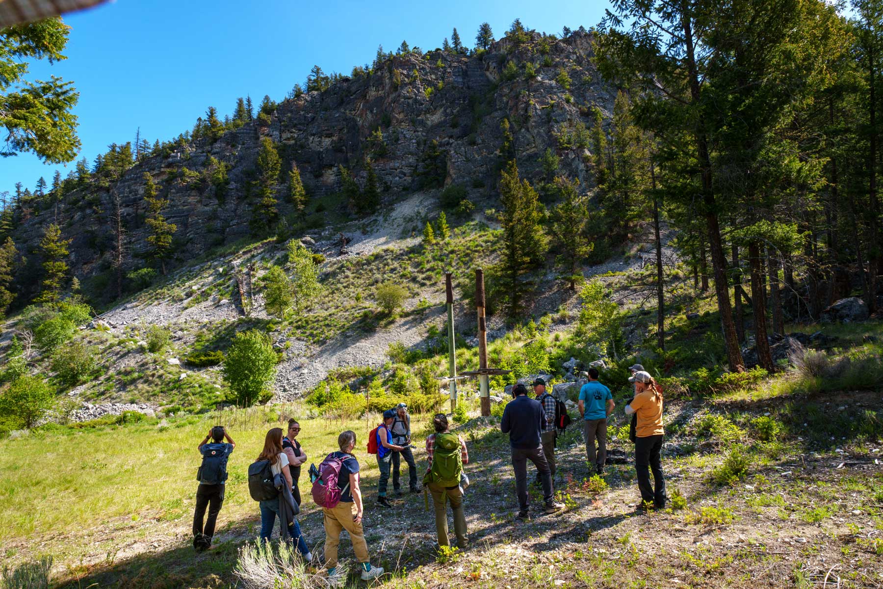
Lot 48: Conserving Bighorn sheep & bats
Pat Morrow
The Kootenay Connectivity Working Group is a welcoming and collaborative space to build trust among partners and foster effective sharing of technical information, local knowledge, perspectives, and strategies to advance corridor science and conservation that enhance wildlife connectivity in the Columbia Valley. Kootenay Connect coordinates this working group which includes Parks Canada Field Units, BC Ministry of Water, Land and Resource Stewardship and Together for Wildlife, BC Parks, Ktunaxa Nation Council, ʔakisq̓nuk First Nation, and Nature Conservancy of Canada. By engaging with multiple agencies and First Nations to align management objectives and activities across different jurisdictions we can better address the needs of wildlife, their habitats and movement corridors. By taking a landscape-level, multi-jurisdictional approach, we’re overcoming the lack of inter-agency coordination of land use and management to provide for wildlife safe passage and access to essential habitats throughout the Columbia Valley. Together, we are developing a process toward establishing inter-jurisdictional recognition of specific ecological corridors, beginning with the Columbia Lake Ecological Corridor.
The Columbia Lake Ecological Corridor is located at a natural crossroads of ecosystems making it an exceptional area for biodiversity within the Rocky Mountain Trench where species from northern and southern regions meet. The presence and movements of Rocky Mountain elk, bighorn sheep, mountain goats, badgers, grizzly bears, and wolverines define this place along with bank swallows, Lewis’s woodpeckers and rare southern maidenhair fern.
Brad Hill
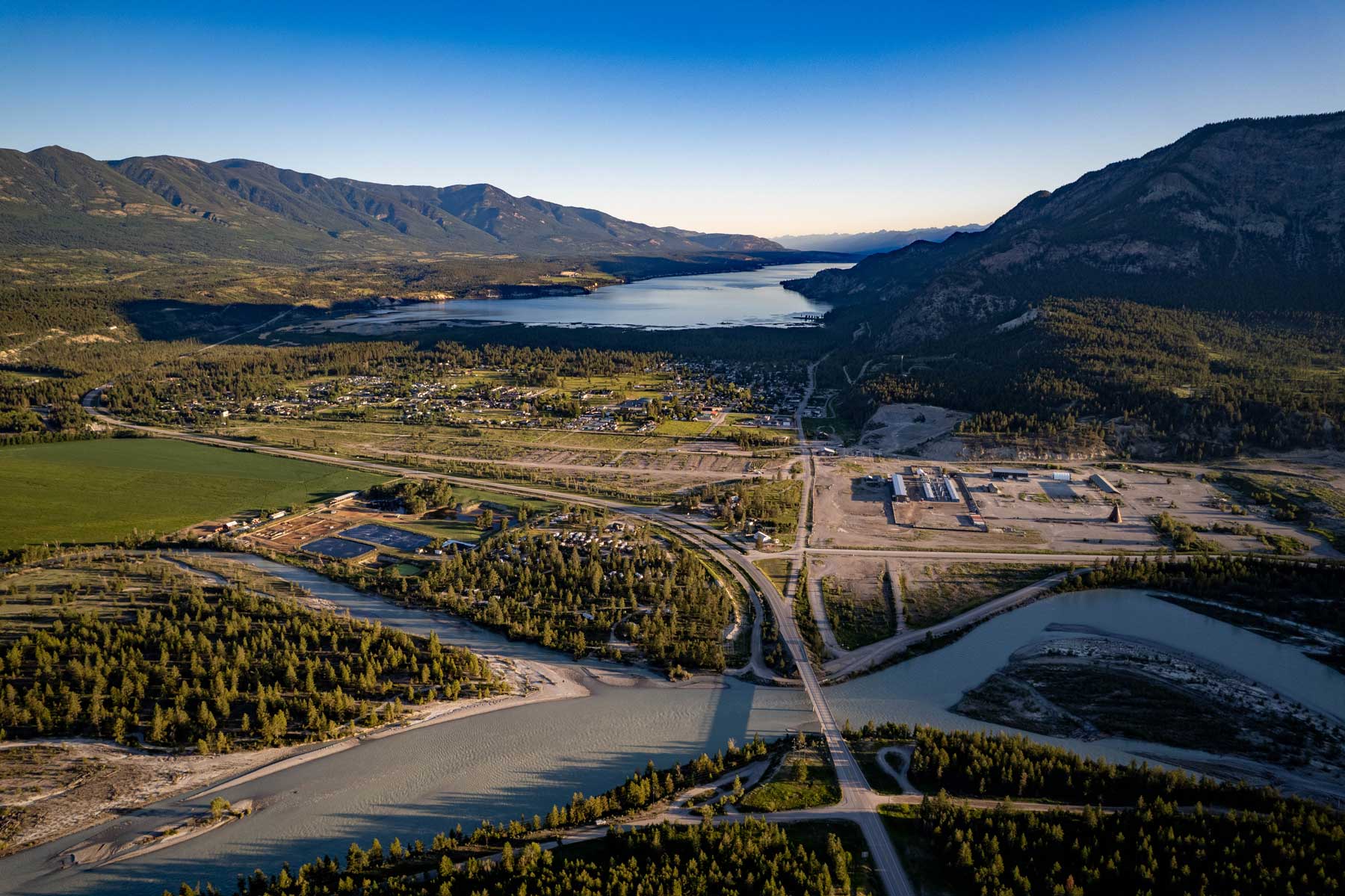
Kootenay River and Canal Flats
Pat Morrow
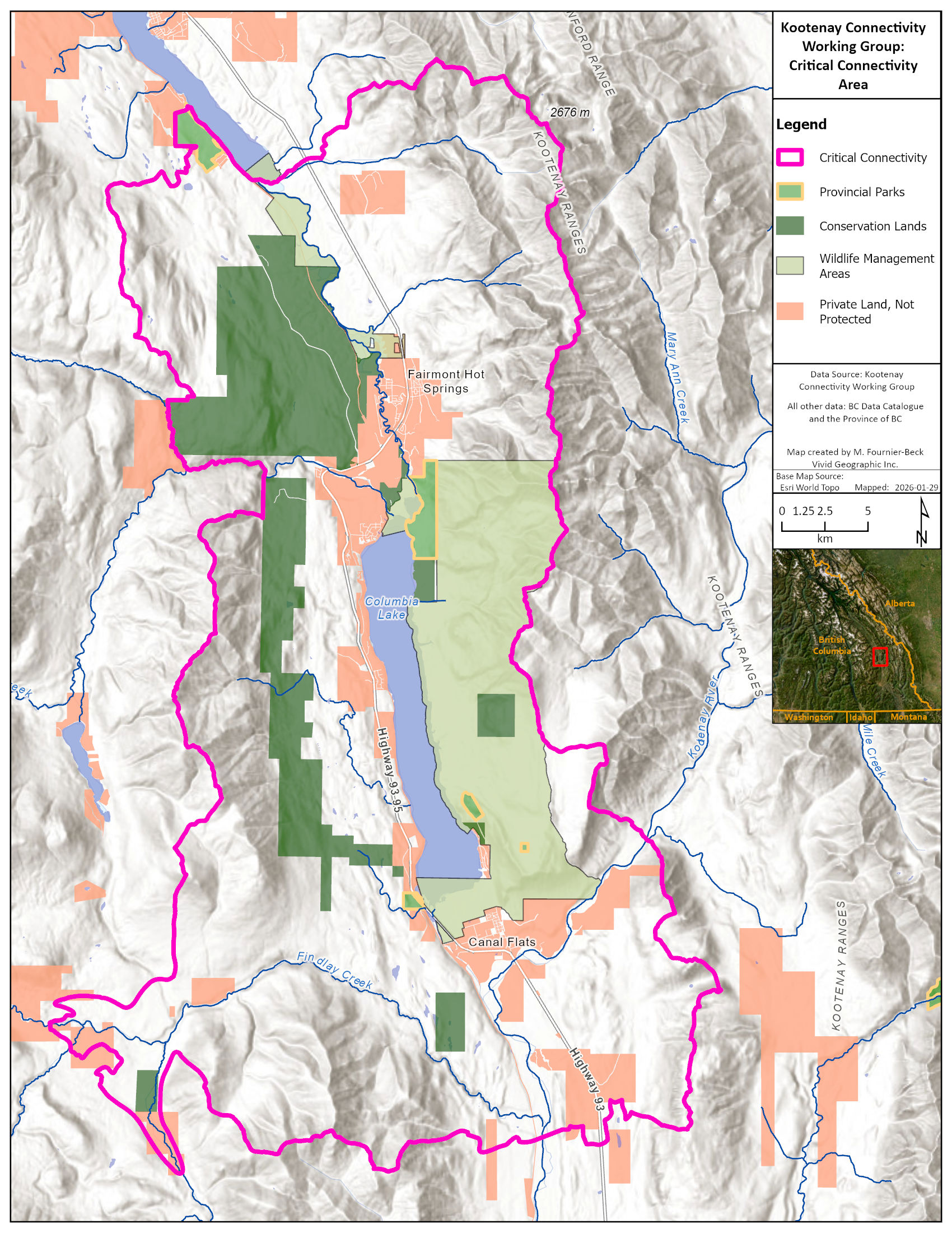
Within the larger corridor is a “Critical Connectivity Area” that encircles Columbia Lake where most of the challenges to connectivity are concentrated. Despite extensive development around the lake, there is still 35% of the land base being managed for conservation by land trusts, the provincial government, and First Nations, including almost the entire east side of the lake.
Backgrounder
Learn more about the
Columbia Lake Ecological Corridor
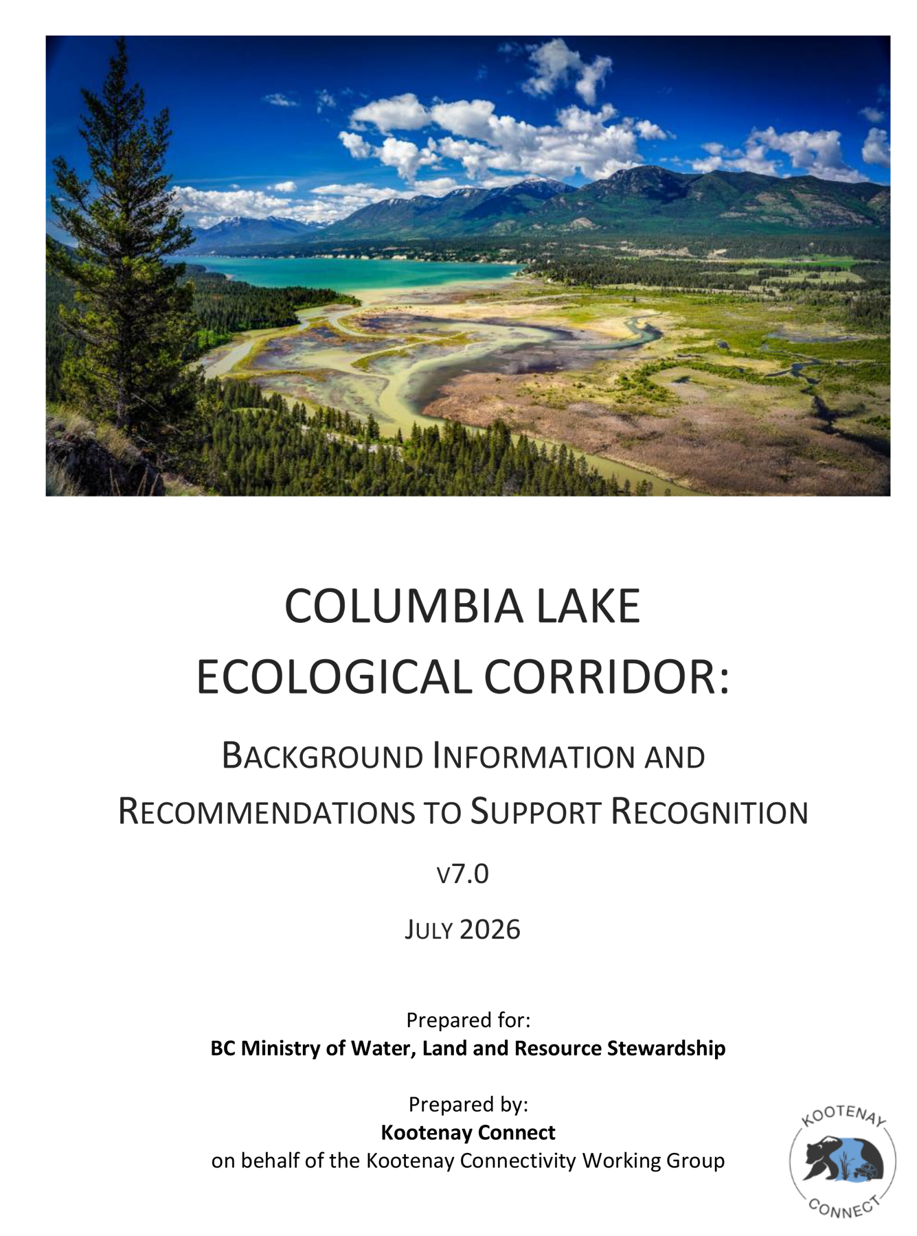
The Columbia Lake Ecological Corridor proposal was developed over five years by the Kootenay Connectivity Working Group, a technical partnership focused on collaboratively conserving multi-species corridors across different land ownerships and jurisdictions in the Upper Columbia Valley. Employing a unique approach to identifying ecological corridors using science and local and Indigenous knowledge, this proposal provides an assessment of key values, threats, and opportunities, as well as management recommendations to inform formal corridor recognition of the Columbia Lake Ecological Corridor by the governments of British Columbia, Canada, Ktunaxa Nation and Regional District of East Kootenay.
Features: Stewardship in Action
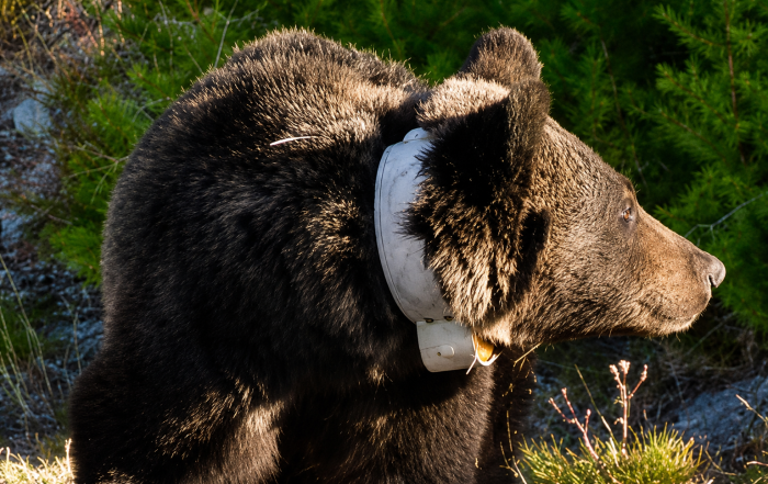
Following Drone Bear
A GPS-collared grizzly bear known as Drone Bear offered a clear example of how wildlife can move through the Columbia Lake landscape. Rather than following a protected area boundary, Drone Bear followed the landscape itself—demonstrating that connectivity depends not on a single park, but on an entire network of connected habitats.
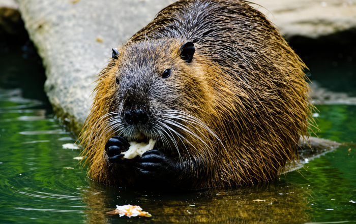
Marion Creek Beavers and the Four Amigos
On the western benchlands above Columbia Lake, beavers are helping demonstrate the value of working with natural systems. Water flows have been significantly altered for irrigation, while drier conditions under climate change have increased the landscape’s vulnerability to drought. Active beaver dams maintain a connected series of ponds in the upper reaches of Marion Creek, creating open water and wetland habitat, moderating water temperatures for west slope cutthroat trout, and providing a dependable source of water downstream.
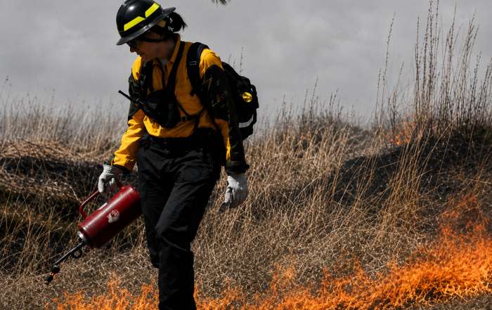
Good Fire, Bad Fire
Fire can either support or disrupt corridor function, depending on its intensity and context. Upland forests and grasslands around Columbia Lake are naturally adapted to fire. At lower elevations, cultural burning historically helped maintain open forest stands and healthy grasslands. Stewarding fire-resilient forests will be important in the years ahead, helping sustain a mosaic of forest ages, maintain mature and old-growth stands, and support functioning wildlife corridors and community safety.
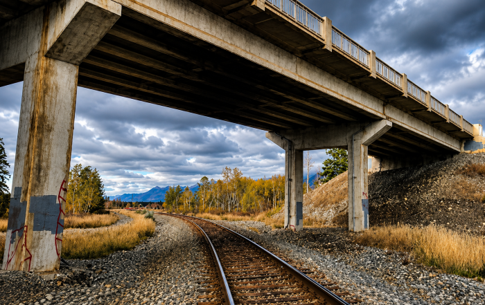
Navigating Development and Yawuʔnik̓’s Ribs
At the north end of Columbia Lake, wildlife must move through one of the corridor’s most constrained areas. This passage includes a challenging mix of housing development, a busy highway, rail infrastructure, an airport, golf course, eight foot-high wildlife-exclusion fencing, and natural landforms, including the Hoodoos or Yawuʔnik̓’s Ribs. Despite these barriers, there are important opportunities for wildlife movement, including the railway underpass below Highway 93/95 and a network of surrounding lands managed for conservation.
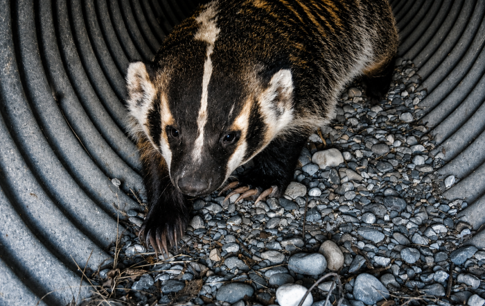
Why Did the Badger Cross the Road?
Badgers need to move, but roads can be deadly. Road mortality is the main threat to badgers in British Columbia and given that Highway 93/95 bisects the Columbia Lake Ecological Corridor, vulnerable badgers are at risk when crossing this busy highway. The hopeful part of the story is that badgers will use existing culverts as underpasses when they are open and accessible. Maintaining existing crossing structures and adding new ones is identified as essential for the recovery of this species at risk.
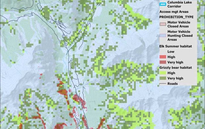
Access affects Elk and Grizzly Bear Habitat Quality
For elk and grizzly bears, good habitat is not enough if disturbance is too high. Both species need a combination of high-quality habitat and habitat security, including areas farther from open roads, to support movement, feeding, reproduction, and survival.
Ktunaxa Forestry Standards
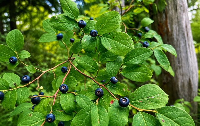
Ktunaxa Nation Council developed Forestry Standards to ensure that more precautionary management of forests consistent with Ktunaxa stewardship responsibility for All Living Things is applied across ɁamakɁis Ktunaxa. Following these standards, forestry and harvesting practices must consider broader forest values and ecosystem services.
kinq̓uq̓anki Stewardship Project
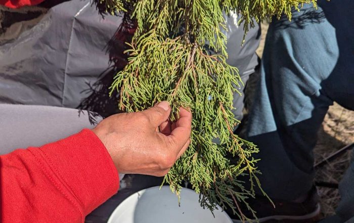
The kinq̓uq̓anki Stewardship Project shows Indigenous-led stewardship in practice. The Ktunaxa Nation Council and ʔakisq̓nuk First Nation have brought together land managers to steward the east side of Columbia Lake for Ktunaxa values. Stewardship actions revolve around reducing forest encroachment, bringing fire back to the land, managing recreation, and inventorying cultural heritage resources.
Check out and join the Columbia Lake Ecological Corridor iNaturalist project!
