
Columbia Lake Ecological Corridor | Features | Drone Bear
A GPS-collared grizzly bear known as Drone Bear offered a clear example of how wildlife can move through the Columbia Lake landscape.
Over several years, tracking data documented the bear moving naturally between the Purcell and Rocky Mountains, crossing forests, wetlands, grasslands, and working landscapes that together form a continuous pathway for wildlife.
Rather than following a protected area boundary, Drone Bear followed the landscape itself—demonstrating that connectivity depends not on a single park, but on an entire network of connected habitats.
The story of Drone Bear reminds us that ecological corridors are not theoretical concepts. They are living landscapes already supporting the daily movements of wildlife.
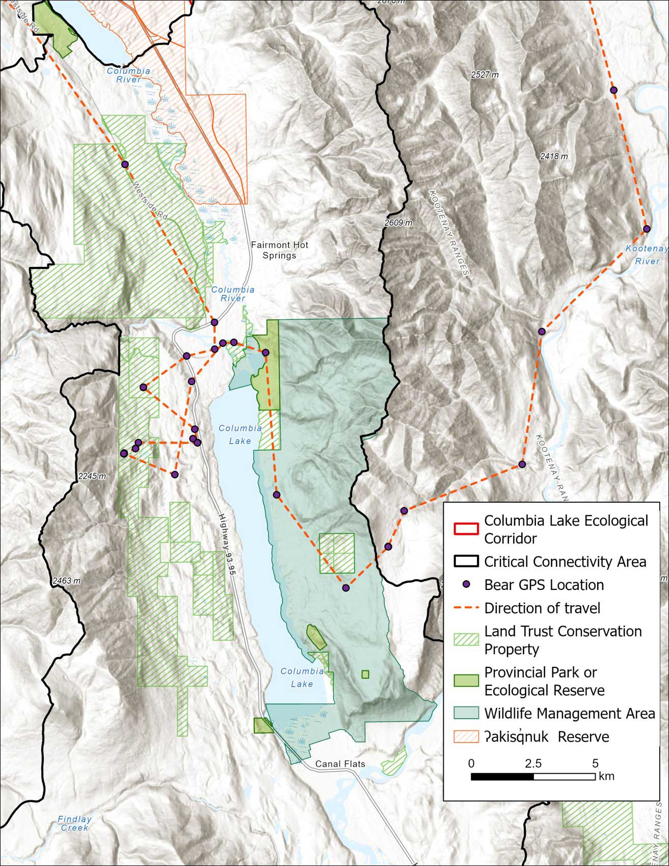
One graphic example of how large mammals can move through the Columbia Lake Corridor exists in a radio collared male grizzly bear, affectionately called “Drone Bear”, who traveled from the high country in the Purcell Mountains to the Rocky Mountains. This bear’s journey took him across the Purcell Wilderness Conservancy heading east to-wards Invermere. Near the Rocky Mountain Trench, the bear veered south, perhaps looking for a place to cross he went as far south as the Marion Creek area on the west side of Columbia Lake. He then returned north, expertly dodging residences to cross agricultural land and wetlands on the north end of the lake, including a recently purchased property by The Nature Trust of BC before making his way down the east side of the lake. Here he passed through the provincial park, wildlife management area and NCC’s Lot 48 before returning north to find a place to hibernate in Kootenay National Park. The following spring Drone Bear retraced his route crossing the valley again for a short visit in a Columbia Lake Corridor (not shown on map) as he made his way north back to the Purcells through the predicted Spillimacheen – Brisco Corridor north of Radium.
Of 17 collar locations within the Critical Corridor Area, 11 were either on conservation properties or agricultural lands in the Farmland Advantage program and two more were located within metres of such properties. This is a clear example of how wildlife can navigate a complicated landscape to find avoid conflict while finding their way to more preferred habitats.
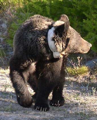
Drone Bear
Sources and Further Reading:
- Proctor, M.F., et al., 2015. Grizzly bear connectivity mapping in the Canada–US transborder region. Journal of Wildlife Management 79:554–55. DOI: 10.1002/jwmg.862
- Proctor, M.F., et al. 2019. The effects of roads and motorized human access on grizzly bear populations in British Columbia and Alberta, Canada. Ursus 30e2:6-19. DOI: 10.2192/URSUS-D-18-00016.2
- Proctor, M.F., et al. 2023. Berries and Bullets: influence of food and mortality risk on grizzly bear in British Columbia. Wildlife Monographs. 213. DOI: 10.1002/wmon.1078